


Nexus OD
Origin-Destination Analytics
.avif)
Built to Understand Movement at Every Scale
Origin-Destination gives you unmatched visibility into where trips begin, where they end, and how they get there. With high-resolution connected vehicle data and robust geospatial analytics, you can uncover travel patterns, pinpoint congestion sources, and make smarter decisions for corridor planning, freight movement, and regional mobility.

01
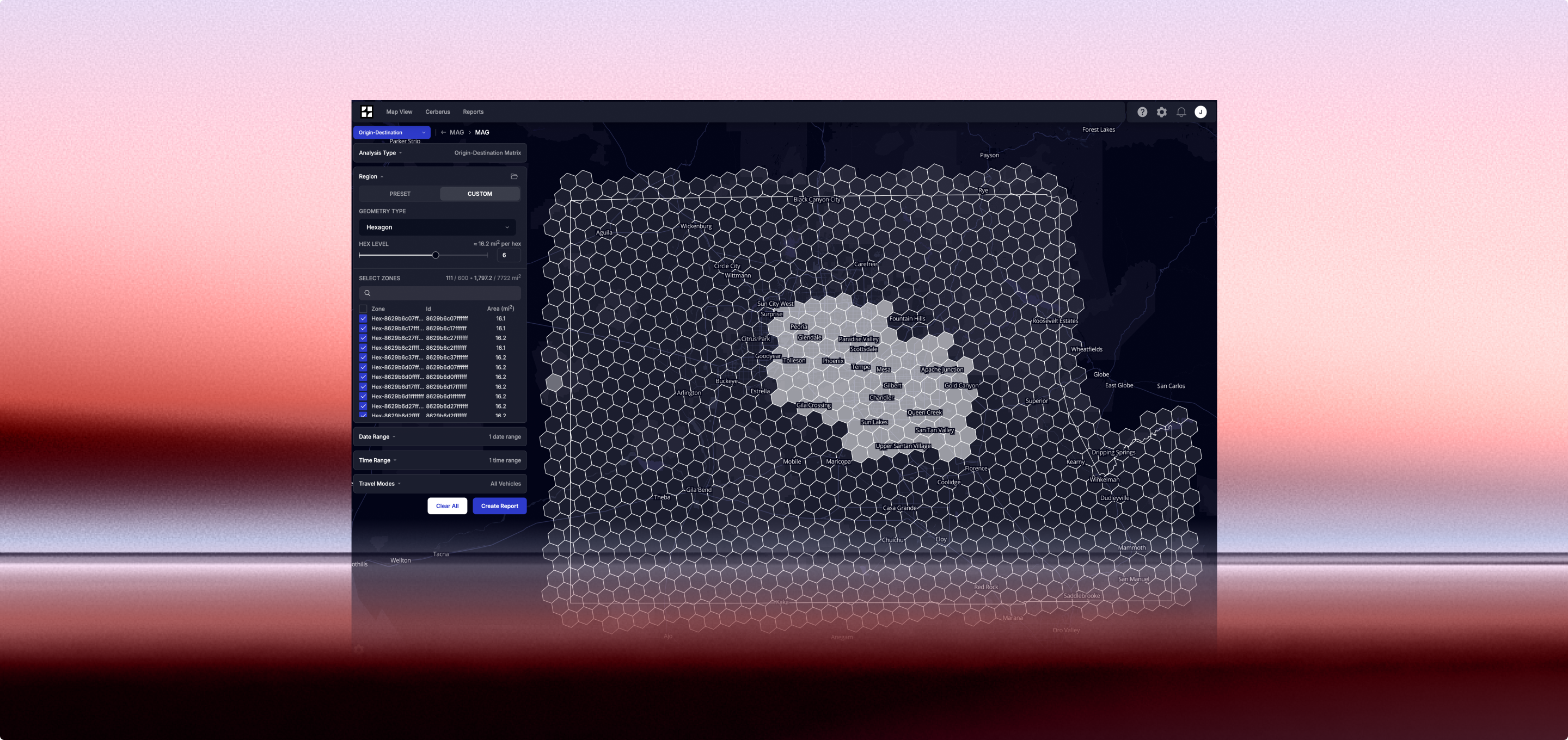
Rapid Configuration & Setup
Nexus OD was designed for flexibility from the very first click. Users can easily upload their own shapefiles and GeoJSONs to define custom regions, corridors, or analysis zones—no complex setup required. Agencies can go from data import to actionable insights in minutes, not weeks.

02
Analyze Travel Demand
Nexus OD generates detailed origin-destination (OD) matrices that show how trips begin, end, and move through a network. Built-in histograms make it simple to visualize distributions of trip durations and distances, helping planners and engineers quickly identify congestion trends, regional connections, and travel time reliability across corridors.
.png)
03
Analyze Routes
Nexus OD’s Link Analysis tool allows users to analyze how vehicles enter and exit specific routes, corridors, or intersections—turning traffic flow into a clear story. Whether assessing the impact of a new diversion, evaluating the effectiveness of an infrastructure improvement, or diagnosing recurring bottlenecks, users can quantify how changes in the network affect real-world mobility.
Tools to Improve Traffic Flow — Not Just Measure It
Flow’s Mobility Management solution is built to help you solve congestion, not just study it. Whether you're diagnosing delay, prioritizing corridors, or evaluating the impact of projects, Flow gives you the insights and tools to make data-driven mobility improvement —quickly and confidently.
Click on the use cases below to see how Flow supports each step.
System Performance Monitoring
Operational Decisions
Evaluation & Reporting
.avif)
Current Experience
Agencies rely on intermittent speed studies or outdated probe data to understand congestion. These sources lack real-time visibility and fail to capture recurring versus non-recurring delays.
Flow Labs
Flow delivers continuous congestion monitoring using high-resolution probe data. Agencies can view live and historical congestion across the network, disaggregate by corridor or intersection, and track changes over time to guide operational strategy.
Solutions
⚃ OUR IMPACT
Proactively saving lives on our roadways
Agencies and engineering teams across the U.S. are using Argus to shift from reactive to preventative safety management. With continuous, behavior-based analytics, you too can detect risk early, act faster, and track impact—long before the next crash report is filed.
.png)
Manage every traffic management system and data in one platform, without the need for new hardware.
.avif)

